 vesseltracker.com
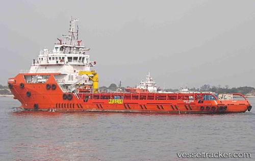
Vessel 'TOPAZ SOPHIE' IMO: 9680657, MMSI: 538005335
UTC, 26.41707, 51.99574, course: 311, speed: 0.4
UTC, 26.41333, 51.98667, course: -1, speed: 4
2026-01-30 17:30:31 UTC, 26.44500, 51.93333, course: -1, speed: 0
Live AIS position:
UTC. Near Al Shaheen terminal),
updated 2026-01-30 17:30:31 UTC.
Find the position of the vessel 'TOPAZ SOPHIE' on the map. The latter are known coordinates and path.
marine traffic ship tracker show on live map
The current position of vessel 'TOPAZ SOPHIE' is 26.44500 lat / 51.93333 lng. Updated: 2026-01-30 17:30:31 UTCDetails:
Last coordinates of the vessel:
UTC, 26.42392, 52.00301, course: 324, speed: 0.2UTC, 26.41707, 51.99574, course: 311, speed: 0.4
UTC, 26.41333, 51.98667, course: -1, speed: 4
2026-01-30 17:30:31 UTC, 26.44500, 51.93333, course: -1, speed: 0